|
|
Land Ownership: It
takes a village to build a city
|
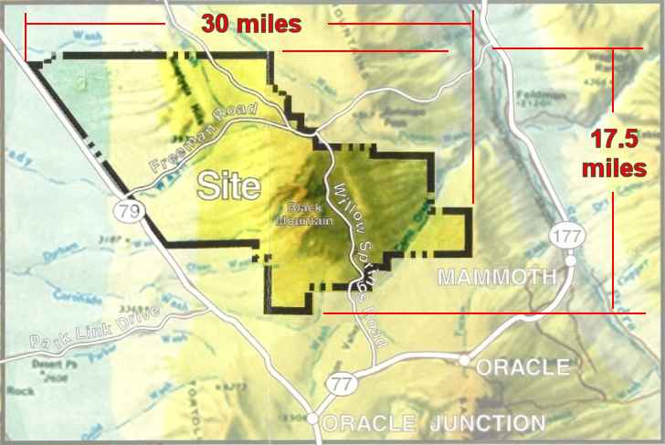
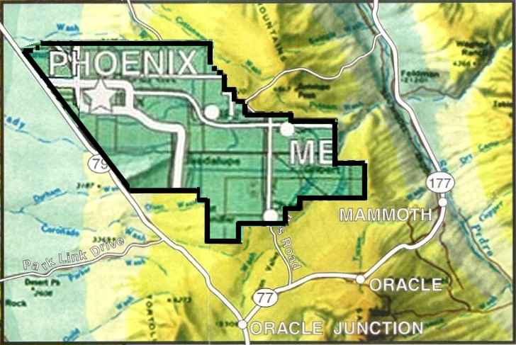
| Potential Size of
Willow Springs City
.
|
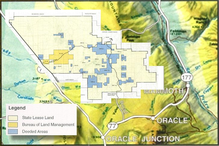
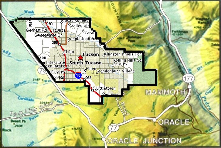
The South "Village"
|
|
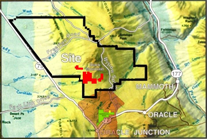
Water Resources The Page-Trowbridge Aquifer & The Water Supply For the South "Village" In September, 2000, Argueta promised Oracle residents the water for Willow Springs development would come "from a different aquifer" than the aquifer that lays under the Page-Trowbridge radioactive/toxic waste landfill. This promise was also made in a flyer mailed to Oracle residents in early September, 2000. As it turns out, this promise was every bit as valid as the promise to conserve open space by not developing state owned land. Another Hollow Promise
|
| Water Demand
Turf Related Demand
|
| Sustainability
Following the September, 2000 meeting with Pinal Citizens for Sustainable Communities, Anam apparently felt a need to say they were committed to the idea of sustainability. To help realize this new found committment, Anam contacted The Regenisis Collaborative Group of New Mexico As of this writing, the function and role of The Regenisis Collaborative Group with respect to the development of the massive Anam Holdings at Willow Springs is not clear, nor is Anam's commitment to the concepts espoused by The Regenisis Collaborative Group clear. One possibility is that Anam has no intention to actually use Regenesis in the design of the Willow Springs city, but is using the group only as a marketing tool to sell the development to local residents. What is clear is that the
goals of the two design groups hired by Anam are at opposite ends of the
spectrum, as evidenced by images on the web sites for the two firms:
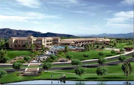
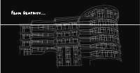
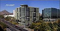
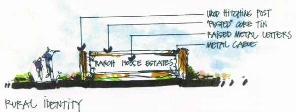
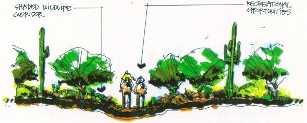
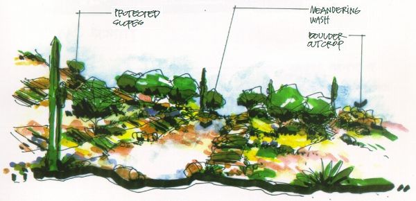
Cornoyer-Hedricks Concept Drawings It is interesting to speculate what a development resulting from the work of these two different organizations would look like (assuming Anam actually uses The Regenesis Collaborative Group in any way other than a simple marketing tool). As of this writing, Anam has not produced any details as to what the architecture of Willow Springs would look like "on the ground," except for a couple of "concept" drawings by Cornoyer-Hedricks. My favorite is the drawing showing the "concept" of the desert (which up until now, I had taken to be a real thing, not a 'concept'). The concept drawing of the desert is complete with arrows pointing out a "meandering wash" and a pile of boulders, helpfully added by the Cornoyer-Hedrick artist to assist newcomers in identifying these objects once construction is completed. Another interesting concept is that of a "wildlife corridor," which doubles as a horse trail. Drawings showing the concept
for signs appear to follow all the Regenesis precepts of sustainability,
at least as nearly as I can tell.
Regenesis Concepts & Claims Since The Regenesis Collaborative Group is new to the Willow Springs project, they apparently haven't had time to do any concept drawings. However, Regenesis principle Tim Murphy spoke at length on the conceptual foundation for Regenesis at the Jan. 8 meeting, which appears to go something like this: Regenerative design and development brings complex human and natural relationships into a mutually beneficial, symbiotic partnership.While the Regenesis representatives failed to elaborate specifics of how the above concept relate to anything at the proposed Willow Springs golf-oriented development, they did make a couple of rather remarkable claims. Saving The Desert Through Development of Golf-Oriented Communities Murphy claimed that the innovative concepts of The Regenesis Collaborative Group would help "restore" the desert, which he said had been badly damaged due to the fact that Anam Inc. has seriously overgrazed the desert in their ranching operation. Apparently the approach is
based on a concept of "in order to save the desert we must develop it,"
analogous to a concept promoted during the Vietnam war with respect to
peasant
An Extraordinary Claim Regenesis principal Ben Haggard stunned the audience with the claim that advanced rainwater harvesting techniques at the Willow Springs "Villages" would not only serve the large development with water, but would actually help replenish the aquifer. The remarkable thing about this claim is that the amount of rainfall on the South "Village" is approximately equal to the expected water demand by the villagers who will live there, according to Cornoyer-Hedrick hydrologist Mark Cross. Thus, in order to replenish the aquifer, two things are necessary:
|
| Reference
1: AMA Overview for the Tucson AMA, chapter 5; published by the Arizona Department of Water Resources (http://www.water.az.gov/), emphasis supplied: In the case where direct use of effluent or effluent recovered within the area of impact is committed to serve the facility and delivery of the effluent will be initiated within four years, but a longer period is necessary for sufficient effluent to be produced to serve the entire facility, the provider will receive a temporary adjustment to its total GPCD [use] requirement with no requirement to use effluent recovered outside the area of impact during the transition period. The adjustment will remain in effect only until sufficient direct use effluent or effluent recovered within the area of impact is available to serve the entire facility, not to exceed eight years. . . . The adjustment will be terminated if the infrastructure necessary to deliver the effluent to the facility is not in place at the beginning of the fourth year after the provider commences service to the facility. |
Use
The 'Back' Button On Your Browser
To
Return To Previous Page
News
& Information
Introduction
![]()
![]() email:mekazda@mindspring.com
email:mekazda@mindspring.com


